Contents
- 1 Top Recommended Apps for Hikers and Backpackers
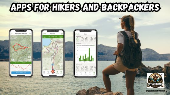
- 2 AllTrails, Gaia GPS, and Hiking Project: My Go-To Choices
- 3 Specialized Apps for Hikers Worth Trying
- 4 How to Get Started With Apps for Hikers
- 5 What to Consider Before Choosing Apps for Hikers
- 6 Next-Level Tips on Apps for Hikers
- 7 Real-World Uses for Apps for Hikers
- 8 Frequently Asked Questions about Apps for Hikers
- 9 Final Thoughts on Apps for Hikers and Backpackers
Since there are countless choices, narrowing down the absolute best apps for hikers and backpackers is super helpful for anyone who wants to get started or step up their outdoor experience. Hiking and backpacking bring a unique sense of adventure and freedom.
QUICK LOOK: Apps for Hikers and Backpackers
- AllTrails: With its vast database, detailed maps, and loads of community-driven reviews and photos, AllTrails has become my base camp for any hike. Recent trip reports are especially helpful before I head out, and offline maps, weather updates, plus the ability to share my real-time location give peace of mind.
- Gaia GPS: Gaia stands out for its precision topo maps and a variety of layers, including satellite and public land boundaries. Its robust GPS tracking is perfect for heading off-grid. The offline navigation stands out in areas with no cell service, and recording my route is both simple and informative for planning future trips.
- Hiking Project: This app shines when exploring areas rich with interconnected trails. It goes beyond just routes by mapping out campgrounds, water sources, and rest stops. The community keeps the info fresh with regular updates and new discoveries.
- Guthook Guides (now called FarOut): Beloved by thru-hikers, it covers legendary trails like the Appalachian and Pacific Crest Trails. These guides lay out distances, detailed maps, elevation, water sources, shelters, and recent updates—all downloadable for use offline.
- PeakVisor: When I want to figure out which mountains I’m staring at, PeakVisor’s augmented reality feature is a true standout. By pointing my camera, I instantly spot summit names and elevations, and it can recommend routes for each peak.
- REI Co-op National Parks Guide: For those planning US national parks trips, this app piles on the trail data, campground details, and insider tips. The offline features are a lifesaver when the signal is unreliable, which is often the case in national parks.
- Ramblr: Ramblr is perfect if you want to create a story out of your trips. It lets you log your route, snap photos, jot down notes, and craft a narrative, all trackable with GPS so friends and family can follow along.
- Cairn: Safety can’t be overstated on the trail. Cairn shares your live location with trusted contacts and estimates your arrival time. It also gathers trail cell coverage reports, so I know when I can check in.
I’ve always found that using the right technology makes my trips safer, more enjoyable, and easier to plan. With so many options out there, having a handpicked set of apps helps with tracking routes, finding trails, identifying peaks, and even keeping tabs on the weather.
Top Recommended Apps for Hikers and Backpackers
App technology in the hiking and backpacking world has grown at an impressive rate. Using these apps is not just about fun; it’s primarily for safety, planning, and making every trip count. In recent years, thousands of new trails have been added, and features like offline maps or crowdsourced tips help ensure I never feel truly lost, even far from civilization.
Trail databases keep growing, and GPS accuracy is now better than ever, which is a real advantage, especially in remote places. Reports have shown that more than half of hikers under 40 depend on at least one smartphone app for navigation and trip planning. I’ve seen these trends with friends and fellow outdoor enthusiasts.
Some apps stem from small groups of passionate hikers, while others are created by big outdoor brands. No matter the origins, the commitment to keeping people safe, informed, and connected to nature is clear in the regular updates and feature improvements.
AllTrails, Gaia GPS, and Hiking Project: My Go-To Choices
When I started researching top hiking apps, AllTrails and Gaia GPS stood out in nearly every list. Both serve casual day hikers and seasoned backpackers alike. They offer extensive trail info, reliable GPS, and solid offline features. The Hiking Project app is also a reliable pick, especially for planning adventures on networks of trails or longer journeys.
- AllTrails: With its vast database, detailed maps, and loads of community-driven reviews and photos, AllTrails has become my base camp for any hike. Recent trip reports are especially helpful before I head out, and offline maps, weather updates, plus the ability to share my real-time location give peace of mind.
- Gaia GPS: Gaia stands out for its precision topo maps and a variety of layers, including satellite and public land boundaries. Its robust GPS tracking is perfect for heading off-grid. The offline navigation stands out in areas with no cell service, and recording my route is both simple and informative for planning future trips.
- Hiking Project: This app shines when exploring areas rich with interconnected trails. It goes beyond just routes by mapping out campgrounds, water sources, and rest stops. The community keeps the info fresh with regular updates and new discoveries.
Specialized Apps for Hikers Worth Trying
Besides the core apps, there are several specialized tools that have given my hiking and backpacking experiences an extra edge. Each of these fills a specific need, from peak identification to safety or storytelling. I make sure to have them ready for distinct situations.
- Guthook Guides (now called FarOut): Beloved by thru-hikers, it covers legendary trails like the Appalachian and Pacific Crest Trails. These guides lay out distances, detailed maps, elevation, water sources, shelters, and recent updates—all downloadable for use offline.
- PeakVisor: When I want to figure out which mountains I’m staring at, PeakVisor’s augmented reality feature is a true standout. By pointing my camera, I instantly spot summit names and elevations, and it can recommend routes for each peak.
- REI Co-op National Parks Guide: For those planning US national parks trips, this app piles on the trail data, campground details, and insider tips. The offline features are a lifesaver when the signal is unreliable, which is often the case in national parks.
- Ramblr: Ramblr is perfect if you want to create a story out of your trips. It lets you log your route, snap photos, jot down notes, and craft a narrative, all trackable with GPS so friends and family can follow along.
- Cairn: Safety can’t be overstated on the trail. Cairn shares your live location with trusted contacts and estimates your arrival time. It also gathers trail cell coverage reports, so I know when I can check in.
How to Get Started With Apps for Hikers
Downloading and using these apps is easy, whether you’re new to hiking or looking to upgrade your outdoor strategies. Here’s my basic approach:
- Pick One or Two Apps: Start with AllTrails or Gaia GPS. Grab the apps, set up a free account, and spend some time browsing trails near you.
- Learn the Features: Take time to check out GPS tracking, offline maps, and weather notifications. These will be invaluable on the trail.
- Try a Short Hike: Take the app for a spin on an easy route near home to practice using GPS, marking waypoints, and reading elevation profiles.
- Use Offline Maps: Always download maps before heading into remote areas. This habit has saved me from getting totally lost more than once.
- Update and Review: Regularly update your app and browse new trail reports. Leave your own reviews—they help the entire adventure community.
These steps, combined with having the right gear, will make you a more confident and safer hiker or backpacker.
What to Consider Before Choosing Apps for Hikers
Not every hiking app fits every need. Think about your personal priorities before committing to a subscription or a specific app. Here’s what I always think about before making a choice:
- Offline Access: Reliable offline maps are a must. Trails often lack cell coverage. This gives you a digital safety net.
- Trail Database: Make sure your app has up-to-date trail data for the places you plan to hike. Recent community reviews are great for checking current trail conditions.
- Ease of Use: A simple, clear interface keeps things quick. Overly complex apps can bog you down when you just want to hit the trail.
- Safety Features: Look for options to share your live location or send checkins. This is very reassuring, especially for solo hikers or people heading out overnight.
- Subscription Costs: Some apps are fine in their free versions. Others require a paid version for useful things like offline maps or advanced GPS. Compare these before you subscribe.
Offline Access Is a Game Changer
Most hiking hiccups happen far from a cell tower. Having apps for hikers with offline maps and saved trail info is a reliable digital safety tool. Download your route and the surrounding area before you leave, and keep emergency contacts stored on your device.
Trail Community and Updates
Apps with big, active trail communities tend to have fresher reports, up-to-date hazard alerts, and unique route tips. Photos and feedback from other hikers help me steer clear of closed or tough trails and stumble upon new favorites.
Weather and Water Sources
Many favorite apps combine weather info or let you mark water sources, both of which are vital for longer adventures. Knowing where I’ll find water and what weather to expect means I’m never caught off guard.
Next-Level Tips on Apps for Hikers
After I got the basics down—tracking routes and using offline maps—I started playing with more advanced features to take my hiking up a notch.
Custom Waypoints: In apps like Gaia GPS or Guthook, I set waypoints for campsites, water, or awesome vistas ahead of the trip. This helps keep things efficient on the trail and limits on-the-spot decision-making.
Import/Export GPX Files: Downloading or sharing GPX route files lets me align my plan with trusted group routes or swap itineraries with friends.
Calendar Sync: AllTrails allows you to export your hiking plans straight to your phone calendar, making it simple to keep track of trip dates and permit deadlines.
AR and Peak Identification: Apps like PeakVisor let you use augmented reality to spot and learn about distant peaks, which adds an educational twist to outings—perfect for group adventures.
The more I use these features, the better prepared I feel every time I set off for a new adventure.
Real-World Uses for Apps for Hikers
On my own hikes and those of my trail buddies, choosing the right apps proved invaluable for:
- Trail Planning: Setting filters in AllTrails or Hiking Project to look for trails that are dogfriendly, familyfriendly, or loops.
- Remote Navigation: Trusting Gaia GPS offline maps and elevation info to stay found and prevent wrong turns.
- Peak Recognition: Using PeakVisor at scenic spots to teach friends about mountain names and heights.
- Water and Camp Scouting: Guthook gives me details on water sources when hiking dry sections of the Pacific Crest Trail or similar routes.
- Safety When Solo: Cairn keeps my real-time location available to family and friends, crucial for solo or risky trips.
Frequently Asked Questions about Apps for Hikers
I hear a lot of questions from people looking to jumpstart their hiking or backpacking adventure. Here are some common answers:
Which hiking app should a beginner use first?
AllTrails is super approachable, covers tons of trails and areas, and is easy to use. Gaia GPS is great for venturing onto longer, more complex trails as you gain confidence.
Can I rely on these hiking apps without cell service?
Yes. Just remember to save offline maps before you head out. GPS itself usually works even when you’re far from cell towers.
How do I keep my phone’s battery alive on long trips?
Bring a small power bank, enable battery-saver mode, and keep the screen brightness low. Turning off Bluetooth and limiting background apps also stretches your charge.
What’s the safest way to hike solo if I’m depending on apps?
Share your route and live location using Cairn or a similar safety tool. And always have emergency contacts saved right on your device.
Final Thoughts on Apps for Hikers and Backpackers
Having the right hiking apps can really step up your outdoor adventures. They’re key in helping me feel safer, discover new trails, and squeeze every bit of enjoyment out of hiking. By trying these apps and getting to know their features, I’ve gone from a casual hiker to a much more prepared backpacker with a deeper appreciation for every trip.
Spending just a little time with these tools will make your next hike more fun and much safer. Happy trails! As always, stay safe, enjoy the journey, and please try to leave it cleaner than you found it.
If you have any comments, questions, ideas, or suggestions, please leave them in the comment section below, and I’ll get back to you ASAP. You can follow us on YouTube: Man Art Creations for videos of our DIY Adventures.
Most Recent Articles:
- Vortex Optics Essentials: Hunting Scope Guide For The Serious Outdoorsman

- Garmin GPS Devices: Navigational Must-Haves For DIY Hunting Expeditions

- Best Rooftop Tents For Overlanding

- Overlanding The Infamous Black Bear Pass In Colorado

- How To Pack A Lightweight Backpack For DIY Backpack Hunting Trips

- Navigating The Hunt Application Process In The US

P.S. Thanks so much for checking out our blog; we really appreciate it. Just so you know, we may receive a commission if you click on some of the links that appear on our site. This helps us keep our content free and up-to-date for everyone. We appreciate your support!