Contents
- 1 Modern Technology and Hunt Scouting
- 2 5 Essential Tech Tools for the Modern Hunter
- 3 How to Use Satellite and Topographical Data for Location Scouting
- 4 The Role of Community, Wildlife Agencies, and Forums in Your Scouting
- 5 Legal and Ethical Considerations in Tech-Assisted Scouting
- 6 Bringing It All Together: Lessons from the Field
- 7 Technology for Scouting DIY Hunting Locations: Final Thoughts
I rely on tech daily, just like you probably do. But when it comes to hunting, the integration of technology might not be as obvious. Here we’ll take a look at how it is transforming the scouting of DIY hunting locations. With the internet, satellite imagery, mapping apps, cellphone trail cameras, drones, and much more, effective use of technology can greatly enhance your scouting efforts.
KEY TAKEAWAYS:
With the advancements in mapping and satellite technologies combined with tools such as weather apps, game cameras, drones, hunting forums, and information from wildlife departments, and forestery agencies, it’s possible to scout potential DIY hunting locations from the comfort of your own home without ever setting foot in the area. However, nothing will ever replace good old boots-on-the-ground scouting. But you can get a good feel for an area, and save yourself time by doing some E-scouting before you get there.
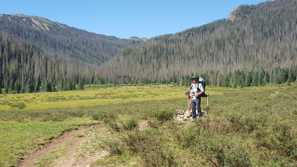
One of, if not the most, important steps in planning a DIY Hunting trip is deciding where you will be hunting. Scouting for hunting locations has historically been boots-on-the-ground work. Think walking miles, tracking signs, and learning the land through personal experience.
And, no amount of technology will ever replace boots on the ground when it comes to scouting hunting locations. It’s rewarding but also time-consuming. But, we now have at our disposal some awesome tools that can greatly improve our scouting and save us hours, if not days, of time.
Modern Technology and Hunt Scouting
If you are planning a DIY hunting trip close to home, boots-on-the-ground scouting may not be a problem. However, if you are planning a hunt out of state, or out of the country, it may not be practical. Enter technology.
This isn’t about shortcuts, but effectiveness and efficiency. Tools like mapping software, weather applications, and trail cameras enhance the scouting process with insights previously unavailable or that would take years to accumulate.
Tech isn’t replacing traditional methods; it enhances them. By integrating technology thoughtfully, I’ve found that you can widen your knowledge of the land, understand wildlife patterns with more precision, and ultimately secure better outcomes when hunting season comes around.
Even if you will be doing boots-on-the-ground scouting, technology can help you narrow down the areas you want to scout in person saving you miles of walking and hours or days. Plus you’ll have a better feel for the terrain, and what to expect when you get there, so you won’t be walking in completely blind.
So, what’s the catch? There isn’t one. It’s about using what’s available to us to become better at what we love doing—hunting. But with the vast array of tools at our disposal, it can be overwhelming to know where to start. Let’s go through some of the essential digital tools every modern hunter should consider when scouting for hunting locations.
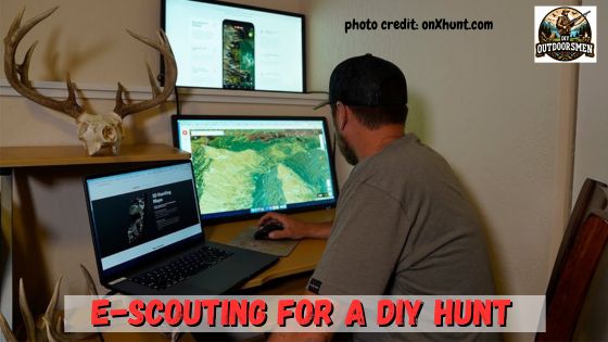
5 Essential Tech Tools for the Modern Hunter
Scouting for the best DIY hunting locations demands precision and up-to-the-minute data. I depend on digital tools to cut down on guesswork and increase my chances of a successful hunt. Essential apps and software can break or make your planning process and can be extremely helpful in the field when scouting or hunting.
Mapping Apps and Software
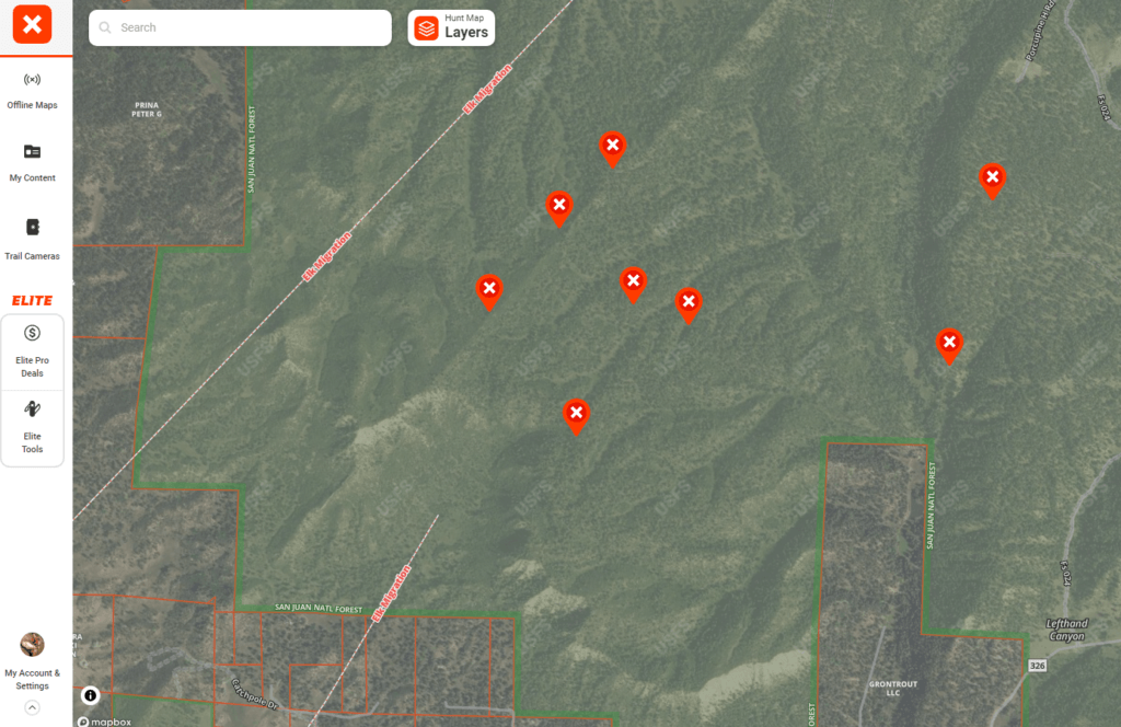
Mapping software, such as onX Hunt, Base Map, or HuntStand, offers comprehensive habitat analysis. They also help dissect a landscape, understand property boundaries, and terrain features, and determine likely animal habitats.
Mapping software often provides satellite, topo, and hybrid base map layers. By overlaying these maps, you can pinpoint trails, feeding areas, and water sources without stepping into the woods.
I’ve used onX Hunt for years and find it, not only a valuable scouting tool but a great GPS and map tool for use during my actual hunts. Now with the available game migration data overlays, you can focus your scouting on those areas most likely to hold game.
Weather Apps
Weather apps are indispensable for timing your expeditions. I use them to track temperature, wind, and precipitation conditions and forecasts. Timing is everything. These apps help you be in the field at the moment when the conditions are just right.
With weather apps, I plan my hunts around the best conditions for animal movement. Elk, for instance, begin migrating when heavy snow starts to accumulate in the high county. I can then focus on migration routes and corridors when hunting.
They can give you historical data on things like average temperatures, snowfall, and other precipitation to help you plan for possible weather conditions both during scouting and hunting trips. Long-range forecasts can warn you of coming storms and alert you to prepare or even to leave ahead of the weather.
Some examples are Accuweather, Weather Underground, and the Weather Channel, these are great for scouting but will require cell service to use in the field. If you will be hunting in an area without cell service, they will not be of much help. So, check your forecast before you lose your phone service.
Trail Cameras and Drones
As for trail camera technology, it has revolutionized the way I scout. Partnered with smartphone apps, they allow remote monitoring of animal activity. No need to disturb the hunting area more than necessary.
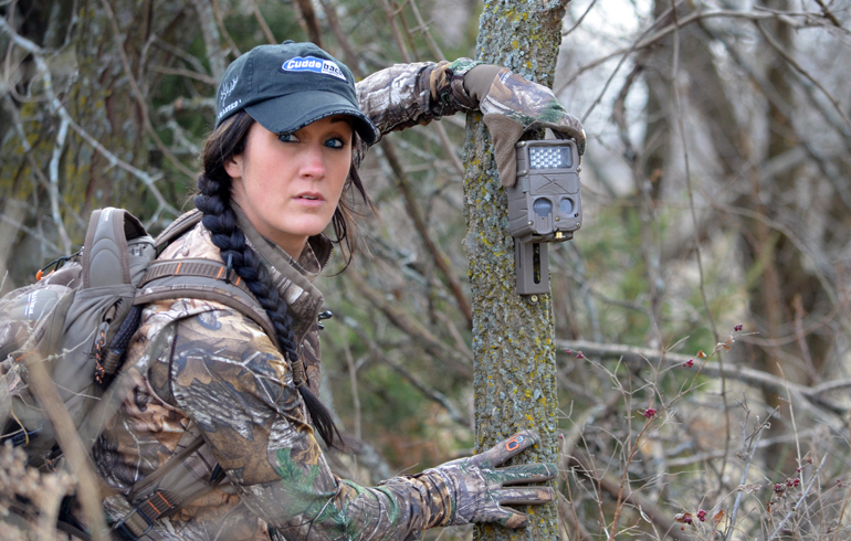
Trail camera apps can alert you to real-time animal movements in the field, letting you know the exact times animals pass through. Be sure to check with the local fish and wildlife department for the specific rules on when and where game cameras are allowed.
Drones are a different matter. They allow you to do an aerial survey of an area in a fraction of the time it would take you to walk it. You may even spot game while scouting with a drone. However, there are numerous restrictions on drone use.
Particularly when it comes to hunting and scouting for game animals. Here again, consult the local fish and wildlife offices for the most up-to-date rules and regulations on drone usage. Drones can be great tools but they can also be abused.
State Wildlife Agency and Forestry Service Mapping Resources
Many State Forestry Agencies and State Fish and Wildlife Departments have mapping tools and resources available for public use. They can be extremely helpful when it comes to scouting a potential DIY hunting location.
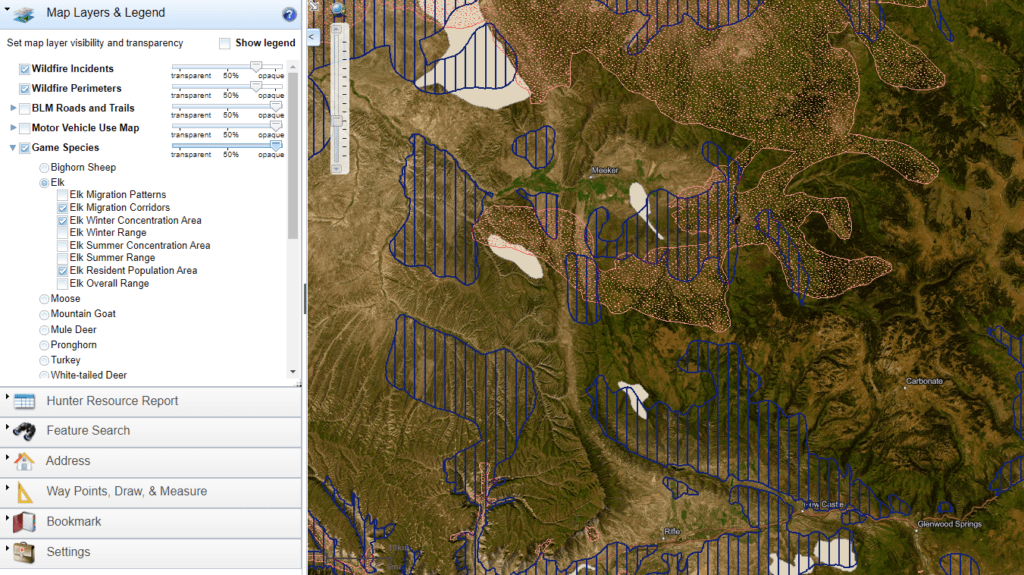
The Fish and Wildlife mapping resources will often include features like game concentrations, migration routes, wintering areas, and resident populations. This can help you focus your scouting on those areas most likely to hold game during your hunt. Check out the following examples:
Map My Property: State of Texas Forestry Service mapping software that includes satellite images for the entire US. This is a great source for finding roads, trails, and terrain features. It won’t have game population data, but for those areas where that is not available, this is a good “free” mapping resource.
Colorado Hunting Atlas: Specific for the state of Colorado with all of the information you get from Map My Property, plus overlays of game population concentrations and migration patterns. It is also “free” for public use. If you are scouting Colorado, it can be a great tool.
How to Use Satellite and Topographical Data for Location Scouting
Satellite imagery and topography are sophisticated tools in a hunter’s arsenal. By accessing satellite data, I can pinpoint terrain features, water sources, and vegetation patterns that are key to locating game from my computer or mobile device without having to travel to or even set foot on the ground.
With satellite views, I observe the landscape as if I’m surveying it from above. This bird’s eye perspective helps me spot natural corridors, such as valleys and ridges, where animals might travel.
Meanwhile, analyzing topography allows me to explore the contours and elevations of the land. Of course, I like to use it to plan my trail in and out of the area for the quietest or least strenuous approach. 😉 Elevation maps highlight areas like hills and hollows where certain game species are known to frequent or bed down.
South-facing slopes in the winter often hold game as they have less snow cover and more sun for warmth. By harnessing this data, you can gain a wealth of information that can reveal potential patterns in animal behavior, such as frequent watering holes or natural pinch points that funnel animal movements.
Topography and satellite data aren’t just pictures; they’re actionable intel. By decoding the terrain, you can strategically place your trail cameras, zero in on promising spots, and plan your routes to enter and exit areas with minimal disturbance.
The Role of Community, Wildlife Agencies, and Forums in Your Scouting
The power of the hunting community is an often underutilized resource. Online hunting forums and groups are more than just places to share stories; they’re goldmines for scouting information.
By engaging with these communities, you can gain insights into animal behavior and habitat from those who frequent the areas or even have hunted the areas you’re interested in. Information, such as timely updates on animal sightings or migration patterns, can be incredibly useful.
Remember, it’s all about CURRENT and ACCURATE data when planning a hunting trip. Combining this communal knowledge with your own observations and research enhances your scouting efficiency and accuracy.
Community feedback can also help you refine your scouting techniques. What worked for others in a specific area could work for you, or conversely, save you from fruitless efforts and wasted time based on their experiences. This sharing of tactics is a crucial piece of the scouting puzzle.
Another valuable resource is the area wildlife biologists. These professionals are in the field year-round actively tracking and assessing game populations and movements. You can look them up on the various state fish and wildlife websites and call them for information. Or, check on YouTube as many states put out video hunting forecasts from the area’s game biologists.
One thing you need to be aware of when dealing with forums and the online community is the validity of the information sourced. It’s important to cross-reference this data with your own findings to ensure reliability and accuracy.
Legal and Ethical Considerations in Tech-Assisted Scouting
I’m a stickler for the rules, and when integrating technology into hunting practices, it’s VITAL to stay on the right side of the law. Each state has its own set of regulations regarding the use of tech in hunting, and it’s your responsibility to be fully versed in these.
For instance, while a trail camera that sends real-time images to your phone may be legal in one state, it could be prohibited in another. Some states ban them entirely during the hunting season. Drones face similar issues and can often be prohibited.
The principle of fair chase must never be lost amidst the excitement of using new tools. Fair chase involves ethical considerations like not using technology to cause unnecessary stress to animals or to gain an unsporting advantage.
Maintaining the privacy of landowners is another concern. Always ensure that your use of technology does not infringe on someone’s property rights or privacy. This means gaining permission for any scouting activity and being mindful of the information you share online about your scouting locations.
Know the property boundaries. Most states take trespassing very seriously. By respecting legal boundaries and ethical codes, we ensure the future of the sport and its continued acceptance in society.
Bringing It All Together: Lessons from the Field
I’ve seen firsthand how powerful these techniques can be. My own experiences echo the successes shown by others in the field. Tech-assisted scouting not only saves time but also offers a level of insight that traditional methods simply can’t match. If you can swing it, I advise you to take the time for some good old-fashioned boots-on-the-ground scouting as well.
Bear in mind, that success isn’t just about using tech for scouting hunt locations—it’s about how you use it. Combining these tools with local knowledge and in-the-field in-person scouting will give you the best results. Remember, technology enhances your skills; it doesn’t replace the need for patience, awareness, and personal experience.
Technology for Scouting DIY Hunting Locations: Final Thoughts
If you’re skeptical about integrating technology with your hunting routine, I encourage you to give it a try. Start with basic apps and tools, and you’ll QUICKLY SEE the benefits. Whether you’re tracking weather patterns, analyzing terrain, or setting up trail cameras, the advantages using technology for scouting can make a significant impact on your ultimate hunting success.
Adaptability is the hallmark of a successful hunter. As you adapt and adopt new technologies, your success in scouting and hunting will grow. Embrace the change, respect the process, and most importantly, enjoy every moment out in the wild, as hunting is not just about the pursuit of game, but about the stories, experiences, and connection to nature that come with it.
As always, stay safe, enjoy the journey and please try to leave it cleaner than you found it. If you have any comments, questions, ideas, or suggestions please leave them in the comment section below and I’ll get back to you ASAP. You can follow us on YouTube: Man Art Creations for videos of our DIY Adventures.
P.S. – Thanks so much for checking out our blog we really appreciate it. Just so you know, we may receive a commission if you click on some of the links that appear on our site. This helps us keep our content free and up-to-date for everyone. We appreciate your support!